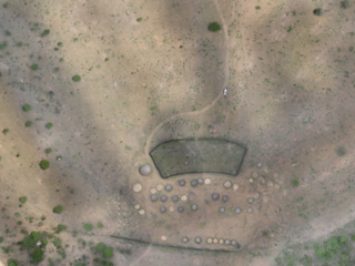
uMgungundlovu( Site)
Attached files

Type
Image
Caption
Excerpt from African Conservation Trust gigapan http://www.gigapan.com/gigapans/186228
File
428a2829889f47419b956e7b4d3aa9f4.jpg
Description
History: From the Ntonjaneni Spring the road descends gently to the valley below. There, at the top of a rise, a minor road to the left leads to the Dinganestat Dutch Reformed Church Mission Station. A few kilometres further on is Mgungundhlovu, one of the most important historical sites in South Africa.
In 1828 Dingane murdered his half-brother Chaka, King of the Zulus, at his royal kraal, Dukuza, where Stanger is now. He then decided to build a new military kraal for himself in the Emakhosini Valley.
The site that Dingane selected for his kraal was extremely well chosen both from a strategic and from a geographical point of view. It lies on the slope of a spur of the Ntonjaneni Hills. The top of this spur, called Singonyama or Lion Mountain, provides a wide view over the whole of the Emakhosini valley. There was a good water supply : the Mkhumbane Spruit comes down from the Ntonjaneni Spring and passes the kraal site on its northern side, while the Nzololo Spruit flowed to the west of the kraal and entered the Mkhumbane a little lower down. Across the Mkhumbane is the hill known as Hiom’ amaButho or Arm the Soldiers Hill; at the northern end of this hill, next to the spruit, there is a spur called KwaMatiwane which Dingane used as a place of execution. The place Dingane chose for his kraal also had important historical and national associations, for the main entrance of the kraal lay in the direction of the grave of Zulu, also called Nkosinkulu, the founder of the Zulu dynasty to which Dingane himself belonged.
Nkosinkulu’s kraal was very probably also situated in the same vicinity. Dingane gave his kraal the name of Mgungundhlovu. Opinions differ as to the meaning of the name. According to H. C. Lugg it is derived from ungungu wendhlovu, which means The secret meeting of the King, and I refers to Dingane’s successful plot to murder Chaka.
James Stuart, on the other hand, expresses the view, based on Zulu tradition, that the kraal was called Mgungundhlovu because it had the shape formed by two elephant tusks placed on the ground, that the name means The Place of the Large Elephant, and that, by transference, it was applied to Dingane himself.
Type
Site
Identifiers
2831AD 004 (National Site Number)
Provenance
None
Spatial
Spatial relationships
- Falls within extents of Map sheet 2831AD (Visual Item)
Makes connections with
- has former or current location Farm Moordplaats No 193 (None)
- is former or current location of No title (A smooth oblong blue-grey stone wi…)
- is former or current location of No title (A schist bead and bangle mould exc…)
Receives connections from
- is former or current location of Visual Item Hut 11 (brewery hut)
- is documented in Document A report on the archaeological and historical investigation of Mgungundlovu, King Dingane kaSenzangakhona's capital from 1829 to 1839 for the period 1 July 1986 to 30 June 1987
- is documented in Visual Item Site map of uMgungundlovu
- is documented in Document Mgungundlovu - -- Honours thesis
- is documented in Visual Item Book: uVUSEZAKITI (Incwadi ye zindaba za Bantu ba kwa Zulu, na ba seNatali)
- witnessed Event Field trip to uMgungundlovu 2019
Archival Status